
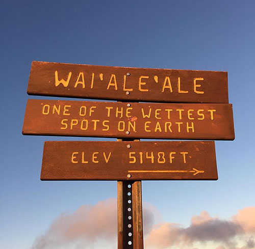
Mount Waialeale on Kauai
Posted on: 04/1/2020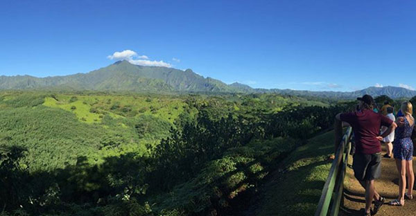
Kaua‘i’s volcanoes have long been dormant, but Mount Waialeale on Kaua‘i sees plenty of flowing each year that has nothing to do with lava. The name Waialeale, meaning “rippling water or overflowing” water in Hawaiian, is inherently accurate, with over 600 inches of rain per year and is known to be one of the wettest spots on earth. It also gets more than five times the amount of rainfall of other mountain peaks on Kaua‘i.
Which explains why Kaua‘i is so green.
The heavy rainfall is also responsible for Kauai’s only swamp, the Alakai Swamp and Wilderness Preserve, a portion of which can be easily hiked on the Alakai Swamp Trail in Kokee. In the early 2000’s, the State built a wooden boardwalk leading through the Alakai Swamp to a scenic outpost overlooking Wainiha Valley and the rest of the north shore. It’s one of the only ways to travel from the west to north on the entire island, since the mountainous Kokee State Park and 16-mile rugged coastline of the Napali Coast are impossible to drive the entire distance.
Very few have ever actually been to the summit of Waialeale, which for the most part is very barren with the exception of some native plants that have adapted to sustain the heavy rainfall. The ancient Hawaiians clearly knew the way following an unmarked foot trail, leaving behind clues of their arrival there such as a heiau, or rock platform, and a small lake that has been altered to divert water to both the east and west. In the early 1900’s, before the use of helicopters, State workers followed the ancient trail by mule as far as they could go before walking the rest of the distance to check Waialeale’s rain gauges. Today, the trail leading to the summit is as difficult as trying to follow a treasure map and search for gold, and we do not recommend trying.
The Weeping Wall
In fact, the recommended way to see Mount Waialeale does not involve trudging through mud, but by helicopter tour. Nearly all helicopter tours on island fly into the Waialeale crater and offer a close up look at this amazing natural wonder. From the helicopter, tour goers will view a curtain of hundreds, if not thousands, of waterfalls blanketing the crater walls. This is called the “weeping walls,” over 5,000 feet of waterfalls flowing to the stream below like tears from the sky.
Although it’s been coined one of the wettest spots on earth, there is no need to worry that the rest of the island will also be covered in clouds. It is very likely that the rest of the island will be completely sunny. Mount Waialeale’s summit is located just below the “trade wind inversion layer” and its steep cliffs cause humid air to rise quickly. In simple terms, rain tends to remain in one spot. Which is good because it means that the rest of the island’s mountain trails and beaches are ready to be explored!